

Glacier National Park was everything we wanted it to be. It is arguably more beautiful than Yellowstone but with far fewer people. Honestly, the two are really such totally different places that they shouldn’t be compared, but I found the dramatic mountains of Glacier hard to beat in terms of beauty. You still need to get off the beaten path to find true wilderness in Glacier but most of the time you can drive through the entire park without encountering a single traffic jam!
We decided that the drive from Yellowstone to Glacier was too far to do in one day so we stopped at the half-way point in the one stop-sign town of Drummond, Montana. There wasn’t much to see in Drummond but it worked well for overnight camping that isn’t a Wal-Mart parking lot. The city park offers RV parking right by the river for $15 with water and electric hook-ups. We were some of the only people there, making it surprisingly peaceful.
I fell asleep during part of our drive the next day, completely missing Flathead Lake, which Brandon said was amazing. It is the largest natural lake in the west and the breezy day had lured out all of the sailors. We briefly considered back-tracking and camping at the lake after Glacier but eventually gave up on the idea in favor of spending more time in Portland. We’re both really looking forward to seeing our old friends and revisiting all of our favorite places in Oregon.
For the next week we’d be staying at the Sundance Campground in Coram, Montana, just a few miles from the west entrance of the National Park. We loved this campground from the moment we pulled up. The place has been run by the same couple for the past 30 years and you can tell that they really care about the place. They were so friendly and welcoming. But what we loved most was that the park felt more like a campground and less like an RV park. There were lots of trees and the layout felt more organic than the typical parking lot layout.
The place got us to thinking about what we would do if we ran a campground of our own. There would be plenty of trees, no clear-cutting of the land. It would be laid out in loops like a state park rather than in parking-lot rows like most RV parks. There would be recycling (surprisingly hard to find at RV parks) and hiking trails. And it would be outside of a cute little town near a lake or river. But most of all, it would be a social park, a place people want to go and hang out. Possibly with a beer garden where we would sell food and drinks and have live music. Think Luckenbach, Texas but with RV camping. Sounds pretty good, right?


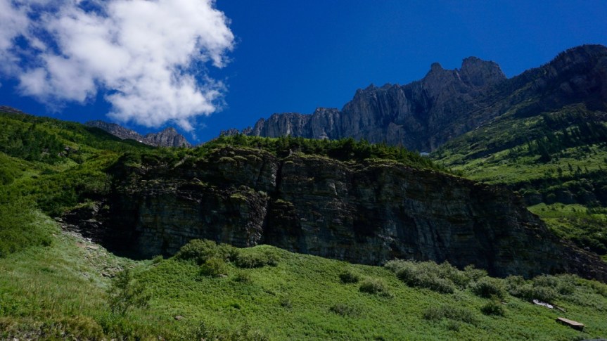
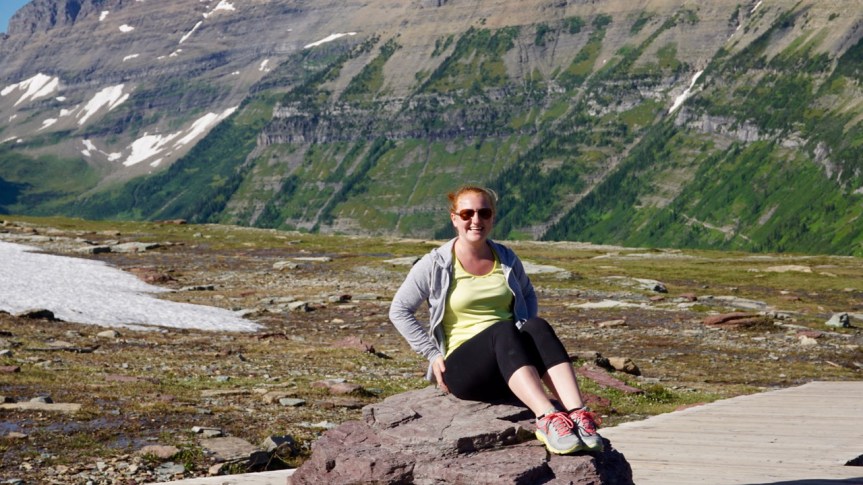
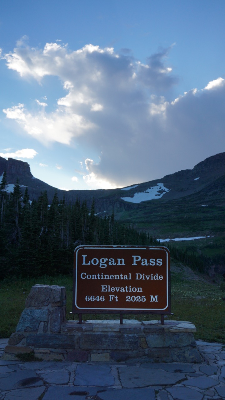
For our first day in the park we decided to do a driving tour. There is really only one road through the park, the Going to the Sun Road, which runs straight through the middle of the park. It is 50 miles from one entrance to the other, crossing Logan’s Pass about half-way through.

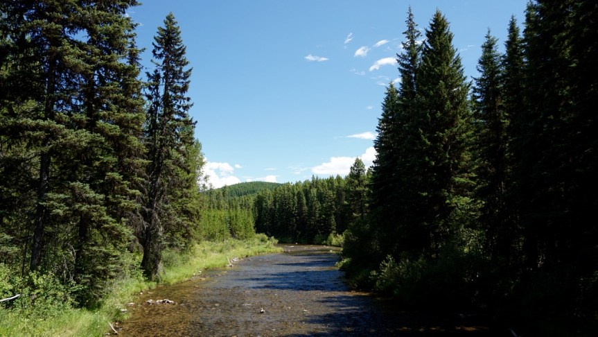
The colors in this river were amazing, almost too bright to be real.

This is truly one of the most breathtaking roads I have ever been on. You drive by Lake McDonald before winding up and up to Logan’s Pass at the top. The road was designed to blend in with the landscape so as not to detract from the natural beauty. The guard rails are made from local rocks and timber. At places water creeps over the cliff edges and onto the road, creating so-called “weeping walls” along the road. The road is perfectly safe but very narrow in places. DO NOT try to drive an RV on this road.

The red version of the National Park tour busses we saw in Yellowstone. We still think these look like a great way to tour the park.

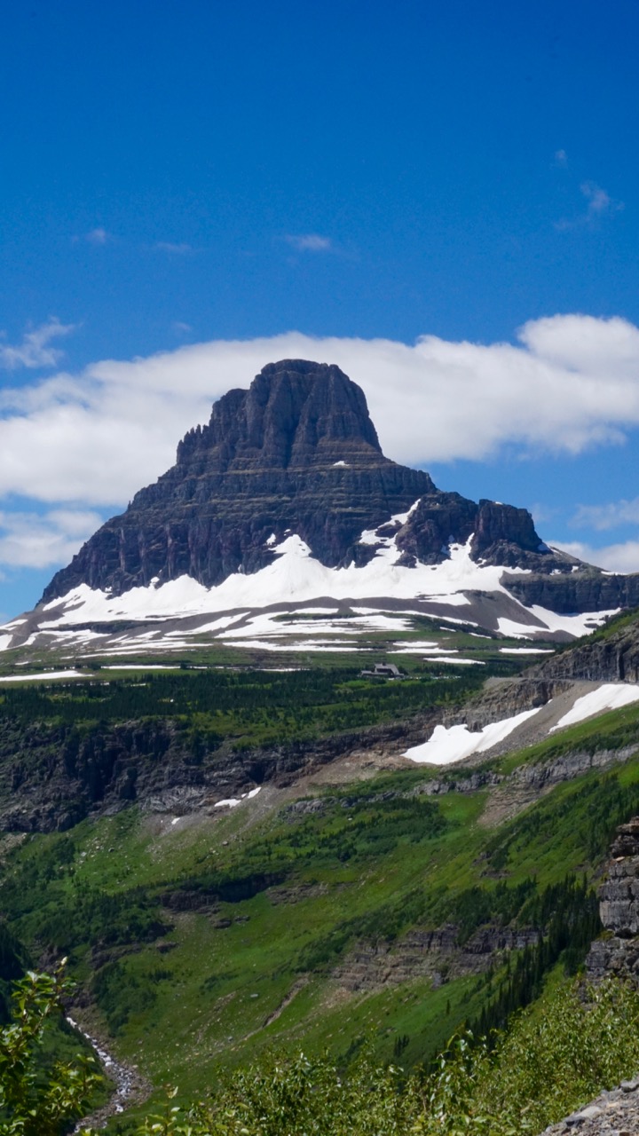
We were too late to find a parking spot at Logan’s Pass (early morning and late afternoon are the least crowded) so we continued on towards St. Mary Lake and the eastern park entrance. The eastern side of the park is strikingly different than the western side. Everything is drier and there is evidence of past wildfires.
We stopped to see the Jackson Glacier on the way down. The viewpoint is on the side of the road, a very long way from the glacier, so it looked smaller than I was expecting. Scientists predict that all of the glaciers in the park will melt in the next 10 to 20 years due to global warming.
St. Mary Lake was a deep blue with a turquoise edge where the water became abruptly deeper.


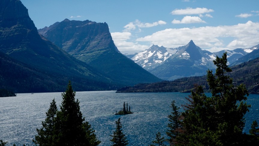
This scene reminded me of the Caribbean islands, except we are in far northern Montana. The fields of grayish purple on the far side of the lake are actually dead trees from either fire or beetle infestation.

We turned around at the east entrance to the park and headed back up the Going to the Sun Road towards Logan’s Pass. This time we were able to find a parking spot. From the visitor’s Center we hiked 1.5 miles to Hidden Lake. This is an awesome hike, not very difficult and gorgeous. There are a lot of stairs so I wouldn’t recommend this hike for everyone, but we did see a huge variety of ages and fitness levels on this trail.
At the bottom right you can see the Visitor’s Center and the winding trail of stairs.


We saw mountain goats right on the trail and walked over snow still not melted in July.


This baby goat and mama goat pair were very popular. They were surrounded by people oohing and awing and taking photos, myself included. They didn’t seem to mind too much as long as we didn’t get too close. Most of the goats we saw were wearing tracking collars.


Hidden Lake gets its name because it is only visible from this viewpoint or by helicopter. Normally, you can hike an additional 1.5 miles down to the edge of the lake, but this section of trail was closed because a mama bear and her cub had taken up residence at the lake.

There were a lot of people hiking this trail. I think this is one of the more popular trails, but there may have been even more people than usual, all hoping for a sight of mama bear and her cub. The lake is pristine, lovely and, per usual, we didn’t see any sign of bears.


This area is full of fluffy mountain goats, more than we saw in any other area of the park. And these guys are seriously not afraid of people. This one was just hanging out on the viewpoint platform, blocking the path while he munched on some tree. You are not supposed to get close to the wildlife, but it’s very hard to keep your distance when the wildlife is blocking the trail or taking a nap 10 feet away.

We drove back to camp after our afternoon hike to spend the evening working on our various projects. Brandon had been needing to replace a worn out body mount on the Jeep and I wanted to catch up on some writing. Overall, a pretty productive evening.

We also spent some time chatting with the campground owner’s niece and her husband. They had recently relocated from Arizona to Montana to help out with the campground. They told us that the most difficult park of running the campground was being “on” seven days a week, sometimes for 14-hours a day. They run up to greet every single person that drives up rather than just waiting in the office. This is a really nice touch, but requires a lot of attention. There is also always something that needs to be fixed or attended to. On the plus side, this is a seasonal park, only open from May to September due to the heavy snow in the area.
We really enjoyed the family that runs this campground (and their many friendly pet cats). If you ever stay here make a point to chat with the family.

The next day we planned a zero day to clean house and, most importantly, go to the grocery store. We were out of nearly everything but boxed soup and trail mix.
Restocking the fridge and pantry felt great and inspired me to do some deep cleaning inside the RV. I finally tackled what I had been calling my “shame bags”. These were three reusable shopping bags full of stuff that I had been lugging around since Portland but never found a place for. They had been stuffed into the bottom of the closet since March. Eeeek! Two were full of last-minute items from our house that didn’t get packed and one contained the contents of my “work purse”.
When I worked at the courthouse in Portland I carried the same gigantic purse every day. Over time it became full of random odds and ends. Bags of tea, tubes of lipstick, hair ties and bobby pins, parking stubs and receipts, ect. The day I left my job I emptied the contents of my desk into this same purse. When we moved into the RV I emptied the purse into a reusable shopping bag and stuffed it into the bottom of the closet. So many levels of avoidance went into creating that bag of shame. But when I finally went through it, and threw about 90% into the garbage, it felt so good. Seriously, if you need a feeling of accomplishment just go to your junk drawer (we all know you have one and it’s probably in your kitchen) and throw nearly everything into the trash. I guarantee you will feel much better afterwards.
We woke up the next morning with literally no desire to get out and see the park, even though we just took a zero day. I think the crowds in Yellowstone really did a number on us. We had already run all of our errands so we just hung out in the RV, reading, watching TV, etc. Around 6pm we decided that we should at least leave the house. We made our way down the street to the nearby Glacier Distillery.
The founders of the distillery claim that the idea for the business was hatched during a particularly rough snow storm. They were snowed in with some friends, drinking whiskey, when they started talking about how they would get by if they had to be truly self-sufficient. One friend said he could build a log cabin, another could garden, a few could hunt or fish, but where would they get their whiskey? The obvious solution was that they needed to start distilling their own and, because this is not the apocalypse, they might as well sell it to the thirsty citizens of Montana.
Brandon had a cocktail made with rosemary lemonade and cherry whiskey and I had the tasting flight. The tasting flight looks like more booze than a cocktail, but it actually isn’t. All four cups amount to one shot. Fun fact: In Montana, a tasting room can get a special tasting room liquor license that is cheaper than a full bar licence. But with a tasting room license they can only serve you two drinks. So each flight, whether beer, wine, or liquor, must be equal to one drink.


Although the Glacier Distillery is primarily a whiskey distillery, they had a huge variety of liquors to choose from. There were whiskeys blended with cherries and huckleberries, a number of different liqueurs and brandies, and even vodka and gin. A little something for everyone.

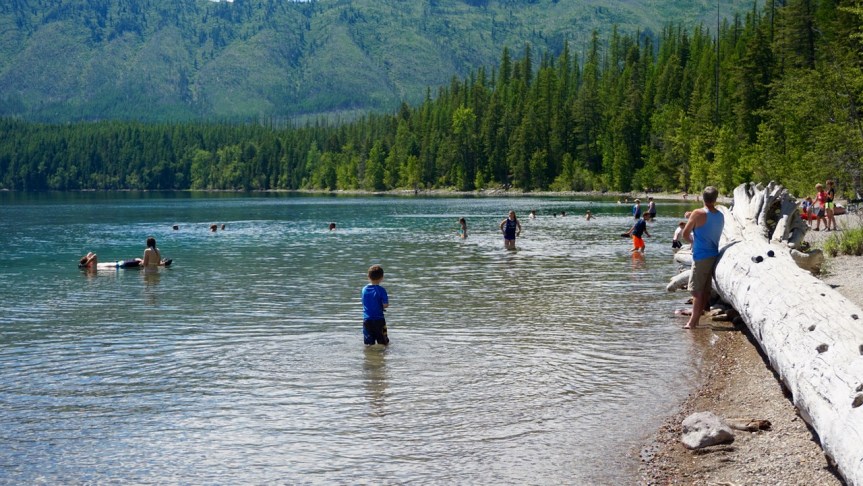
Our plan for the following morning was to drive the Inside North Fork Road, which is a dirt road running from the Apgar Visitor Center up the whole west side of the park. But first, we stopped at the Fish Creek picnic area on Lake McDonald for a picnic lunch and some rock skipping.

For lunch we had pin wheel sandwiches, pickles, chips and salsa, beef jerky, cheese sticks, and watermelon sun tea.

This picnic area is also a really popular swimming spot.
Inside North Fork Road was a great place to see the fire and regrowth cycle of the forest up close.

Unfortunately, after about 10 miles we came across a sign saying that the rest of the road was closed to everyone but hikers and bikers. We had no choice but to turn around. We drove back to the visitor center and took Camas Road up the west side of the park. Camas Road ends afer 11 miles at the western entrance to the park. We decided to continue on along Outside North Fork Road and into the Flathead National Forest. We eventually came to a sign for the Hay Creek Forest area and a dirt road into the forest. We turned left onto the dirt road just because it looked interesting. We didn’t have a map of this area or enough cell service to use our phones, but we kept track of landmarks we saw and turns we made to make sure we could at least backtrack if we got lost.

We drove all the way to where the road ended at a trail for hikers and bikers. Along the way we found side roads down to the river and a few back country campsites. We also found bear scat and LOTS of mosquitos. I’m not sure I would actually want to camp here.


The end of the road. Past these boulders was a hiking and biking trail to who knows where. We turned around and made our way back to the main road.

Out of the woods and back in “civilization”.


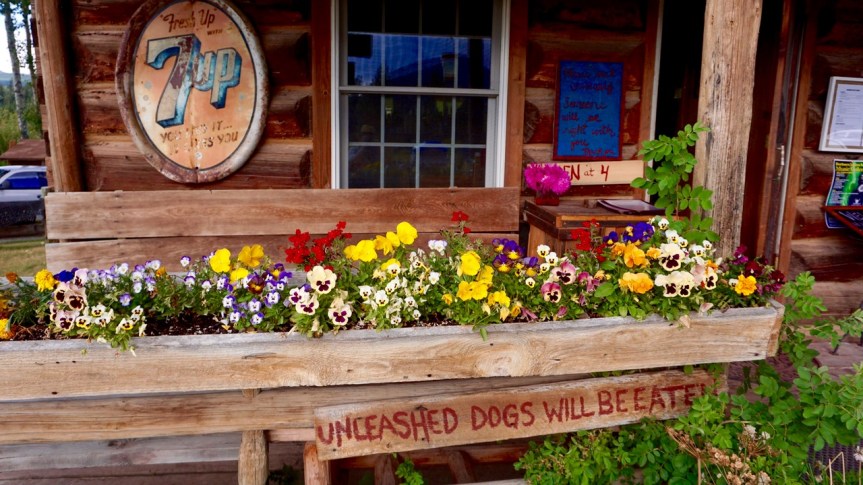
Our goal had been to drive to Bowman Lake but we only made it as far as the town of Polebridge because, well, Polebridge is awesome!

Polebridge was the original merchant outpost for this very remote area and continues to operate as the “town” for the people living nearby. Everything is off-grid. They run off of solar power, with a back-up diesel generator, and have outhouses for restrooms. There is no cell service but they have one pay phone and one computer with satellite internet.
But for what they lack in modern convieniences they make up for with a sense of community. We felt welcomed as soon as arrived.
There is a small general store and bakery, a resturant with live music, rental cabins, and a vollyball court.


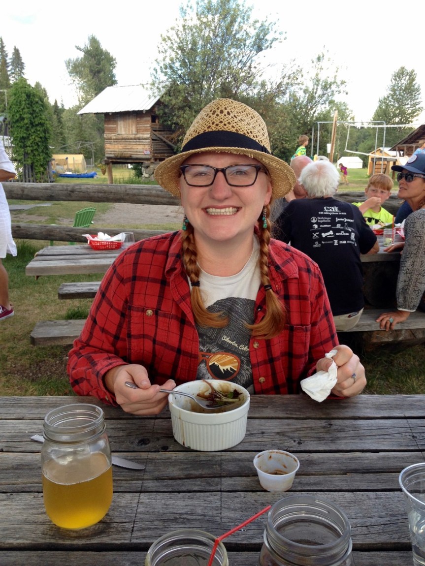
We couldn’t help but stick around for dinner. I had chili cheese fries and a salad with the best tomatoes I’ve had in a long time and Brandon had the elk burger.

Brandon insisted that this photo make it onto the blog . . .


This dog lost one of its front legs to cancer and was still learning how to walk on three legs. She was very sweet. The owner said she was a mix of German shepard, Alaskan malamute, and wolf.

Everything in Polebridge had character, right down to the little library and the outhouses.


We left when it started to look like rain. We ended up driving right through the storm and into the rainbow on the other side.


For our finally day in Glacier and as an end to our national parks tour (for now at least) we did something extravagant and spectacular.

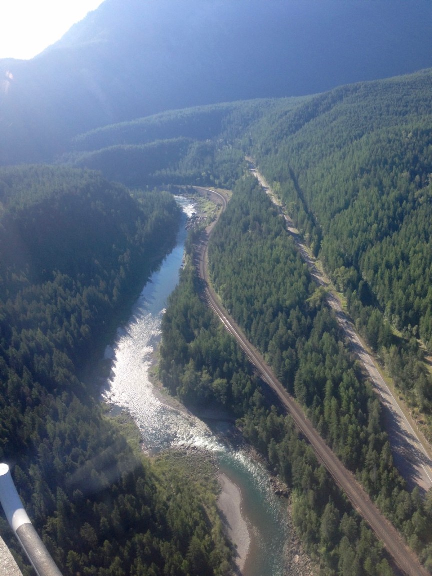
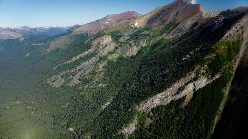
Brandon has always wanted to ride in a helicopter and Glacier seemed like the perfect place for it. The park encompasses more than a million acres, most of which is difficult to access and rarely touched by people. From a helicopter we could see just about all of it in one hour. Helicopter rides are not cheap ($250 a person for one hour) but so totally worth it. I mean, just look at how happy he looks!

It’s difficult to even describe the experience. It was just so surreal.

From the air you can actually see how ancient ice sheets carved out the landscape.


The start of the Going to the Sun Road from above.


Yes, we really are as close as it appears.

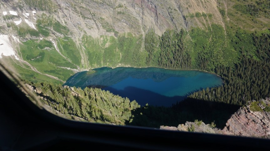
A hidden mountain lake full of floating ice.

The glaciers never fully melt in summer, but the top layer of snow melts away creating long waterfalls down the mountain.

Notice the lines of pink snow. We saw this on many of the glaciers.

The pink snow is actually a bad sign for the glaciers.

Pink snow is caused by a particular type of algae. Each summer this algae begins to grow in the water left from the melting top layer of snow. The pink algae isn’t necessarily new but its prevalence is. The problem is that the algae has a snowball effect on the melting glaciers.

White snow relflects the most light so white snow melts the slowest. Pink snow reflects less light and melts faster. The more glaciers and snow melt, the more algae forms. The more algae forms, the more sunlight it absorbs, causing more melting. The pink snow isn’t necessarily causing global warming but it is a sign that the glaciers are melting exponentially faster. This is happening here in the national park as well as in the arctic.

Here you can see the Canadian border. It is literally just a line of cleared trees.
Glacier National Park (or more technically, Waterton-Glacier International Peace Park) is the only national park to cross the U.S. border. A portion of the park is actually in Alberta, Canada and is called Waterton Lakes National Park.

There are so many lakes in the park, most of which are completely inaccessible by car.
Lake McDonald from the air. The turquoise line you see around the edge is the deep water drop off.

Back on solid ground.

Just in case you missed the sneak peek I posted a while back with this video of our helitour!
Our helitour was at 9am so we still had most of the day left when we were done. We stopped back by the RV for lunch before returning to the park to hike a few of the shorter trails.
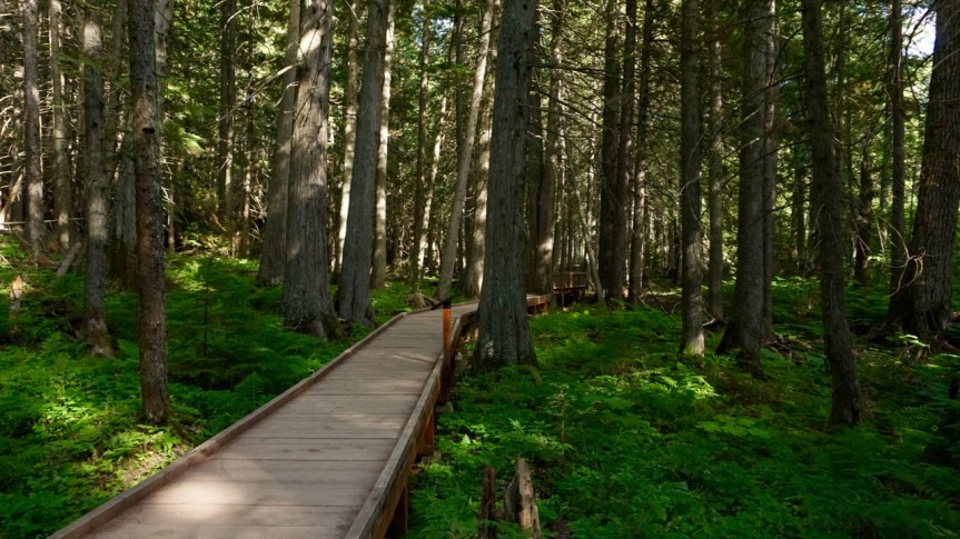
The first was the Trail of the Cedars, a short nature trail near the beginning of the Going to the Sun Road. Most of the trail is along this lovely little boardwalk.
We thought the growth on this tree looked like a heart.

And the roots on this fallen tree reminded us of Game of Thrones.

We crossed a bridge over this rushing stream.


From the Trail of the Cedars we made our way back up the mountain towards Logan’s Pass.

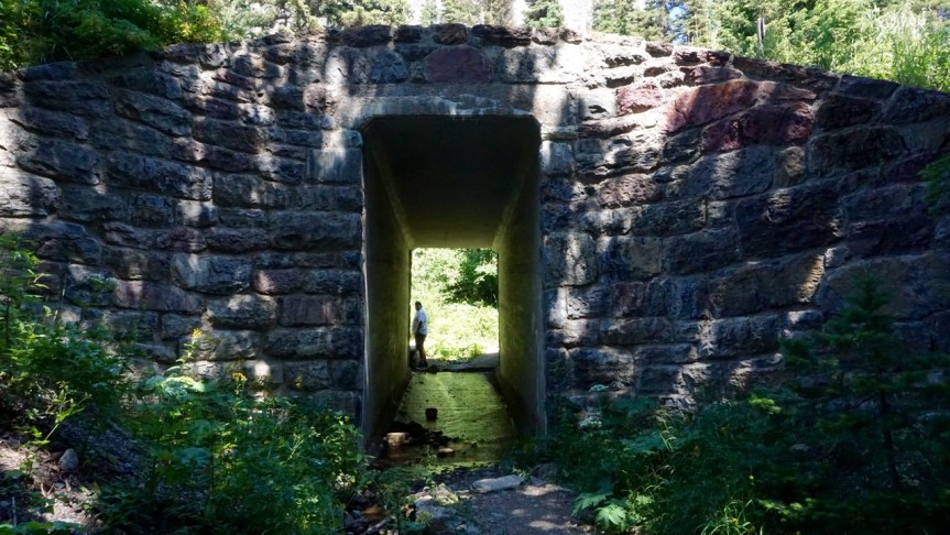
We stopped at this tunnel just because it looked interesting. Then we saw the double rainbow.


Seriously, I have seen more double rainbows in the past year than I have in my entire lifetime. Not that I’m complaining.


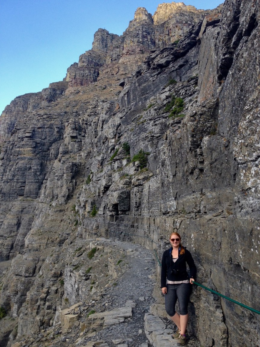
We once again stopped at the Logan’s Pass Visitor Center, this time to hike a small portion of the Highline Trail.
The Highline Trail is the most popular trail in the park, but most people (like us) only hike the first section of the trail. The entire trail is over 11 miles long and takes a full day to complete. But the first section is what makes this trail so popular.
After a short walk from the visitor center the trail suddenly comes to a steep cliff and follows along the edge, providing breathtaking views of the valley below.

It sounds scarier than it actually is. The path is wide and level and there is a rope to hold the entire way. Despite what this blog might suggest, heights actually make me very nervous, and I was totally okay on this trail.


We saw this little plant on the hike back. It reminded me of Dr. Seuss’s The Lorax.


The sunset on the drive home was a perfect end to the day. We’d climbed mountains and flew high in the sky, and tomorrow we would return to one of our favorite places, the Pacific Northwest!


Way cool.
LikeLike
” Think Luckenbach, Texas but with RV camping. Sounds pretty good, right?” Plus, cooler in the summer which means New England, or the Rockies, maybe in New Mexico. Plus Brandon needs a big machine shop for repairs and “hobbies.” Plus near a town where Jenny can lawyer. Sounds like a great lifetime career to me!
LikeLike
Haha, yes Brandon “needs” a big machine shop! He’s very happy you agree!
LikeLike
I’m with Bob. Hope to get to visit your RV World someday. I think I would like to visit Glacier National Park. I’ve never spent any time in Montana really. Thanks for sharing.
LikeLike
Of course you can come stay at our park! We’re also hoping you’ll help us book the music ; )
LikeLike
very beautiful!
LikeLike
Fabulous rainbow shots! Once again, you guys are on a grand journey and smiling all the way!
LikeLike
Thank you! Rainbows are surprisingly hard to photograph!
LikeLike
Still way cool! Maybe I’ll go to the Grand Tetons. . I’ve never been there before either. It all looks grand. Love you both. Thanks for sharing.
LikeLike